Google Maps expands regional COVID-19 details as cases rise, Live Crowd has been added to public transportation
Google Maps will now display all detected cases in an area, the latest seven-day average trend, and the number of deaths there.before leaving for the holidays.
- by B2B Desk 2020-11-18 08:26:55
Google Maps will now display all detected cases in an area, the latest seven-day average trend, and the number of deaths there.
Google Maps will now display all detected cases in an area, the latest seven-day average trend, and the number of deaths there.before leaving for the holidays. These characteristics come at a time when cases are increasing again and fears of disease spreading during the winter and Christmas season. Google Maps seeks to provide more information from official COVID-19 resources. It will show you information that includes all cases detected in an area, the latest trend of the seven-day average, and the number of deaths there, to give you a clear picture of the situation before heading to that area. Additionally, Google Maps will also provide live information about congestion on public transport.
Google announced in a blog that it is rolling out two new features that aim to provide you with more information that will definitely help you during the COVID-19 crisis. The first includes the ability to view more COVID-19 information about the area, including cases detected at all times, quick links to COVID resources from local authorities, the seven-day trend there (increase or decrease), and the total number of deaths. Google says this additional information "will be especially helpful if you are heading out of town and need to keep up with local guidelines, test sites and restrictions in another city."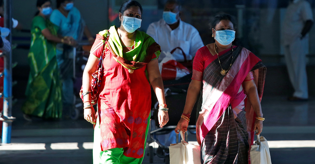
Apart from this, Google Maps will also endeavour to provide you with direct information about agglomeration in public transportation for your perusal. Cautious users who want to keep their distances may want to avoid crowded buses. Google Maps will now start showing how congested a bus, train or subway line is right now based on real-time feedback from Google users. Both features are rolling out for Android and iOS.
In addition to these functions, users can also view the live status of receiving and delivery orders. This feature will let you see when the food is expected to arrive or when to pick it up. This feature will also provide information such as expected lead times and delivery rates and will also allow you to reorder your favourite items from within the Google Maps app itself. This feature is rolling out on Android and iOS to users in India, Australia, Brazil, Canada, Germany, and the United States.
Additionally, a preview of Google Assistant's driving model is being rolled out in Maps for US Android users, and this feature mainly seeks to reduce the need to look at your phone while driving. The new easy-to-operate assistant interface allows you to use your voice to send and receive calls and text messages, quickly check new messages in your messaging apps in one place, and read your text messages. The assistant will alert you to an incoming call so you can answer or reject with voice commands.
Also Read: 7 Critical Building Blocks for Small Business Success in 2021
POPULAR POSTS
What Is LLM Visibility? A Simple Guide to Checking Your AI Visibility
by Aakash Ladha , 2026-07-15 11:44:33
OpenAI Launches GPT-Live: Making Conversations with ChatGPT Feel Truly Human
by Aayush Ladha, 2026-07-14 12:28:52
Otobot Technologies: Driving the Future of Automotive Innovation
by Aayush Ladha, 2026-07-06 12:06:39
Speakers United Concludes Its Biggest Debate Camp Yet 80 Students, Zero AI Assistance
by Aayush Ladha, 2026-07-01 11:26:25
The Agentic Revolution: Why Salesforce Is Betting Its Future on AI Agents
by Shan, 2025-11-05 10:29:23
OpenAI Offers ChatGPT Go Free in India: What’s Behind This Big AI Giveaway?
by Shan, 2025-10-28 12:19:11
Zoho Products: Complete List, Launch Years, and What Each One Does
by Shan, 2025-10-13 12:11:43
Follow on Insta
RECENTLY PUBLISHED
How Praveen Gowdru Went From Building VMEDO To Launching Tez Health And Why He Betting On Home Healthcare
- by Aakash Ladha , 2026-07-01 11:01:27
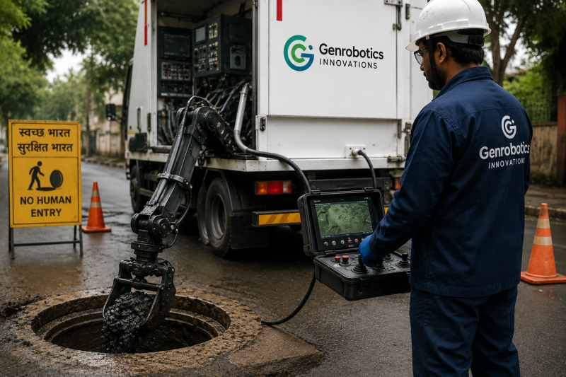
How a Kerala Startup is Using Robots to Clean Sewers and Manholes
- by Aakash Ladha , 2026-07-14 12:14:26

Luxemettle Redefining Indias Jewellery Market With Personalized Craftsmanship and Story Driven Design
- by Aakash Ladha , 2026-07-14 12:07:23


x
![logo]()